Great Plains | A treasure map for your fields
Soil sensing and mapping solution TrueView by Great Plains
The Challenge
Not all soils are created equal
The soils of our fields can vary greatly. Some spots may be moist, others dry, some may contain sediments of sand, clay or rocks. Soil type impacts crop growth significantly: Among other things, it affects water intake, nitrogen leaching and denitrification. For this reason, crops planted with the same seeding rate, population and inputs will usually produce varying yields.
We can improve the profitability of our fields by managing soil types individually. But how to identify them accurately?
Farmers often have a rough understanding of where the better soils in a field are located. But different soils may only be meters apart, so that is not good enough. The same goes for grid sampling. Moreover, if you have an imprecise map of your field, your efforts may even do more harm than good.
Solution
Sensing soils in real-time, creating highly detailed field maps
The soil sensing and mapping solution TrueViewby Great Plains makes sure farmers do not fail in their efforts. With TrueView’s highly accurate real-time information, you will always find the exact location of different soil types and conditions.
During tillage operation the real-time data can tell the farmer if he should make adjustment to his tillage machine settings. In a last pass just before planting, TrueView can identify when detecting problematic soil temperatures or moisture that affects germination and emergence. A tillage pass done so precisely creates better seedbeds without changes in density and with less compaction. In addition, it will save you a significant amount of time and fuel.
But this is not all. TrueView also captures data about the most important physical, biological and chemical properties of your field and converts it into data troves and highly-detailed soil maps. The data and maps are used to create application-specific management zones that help you in optimizing your rate application.
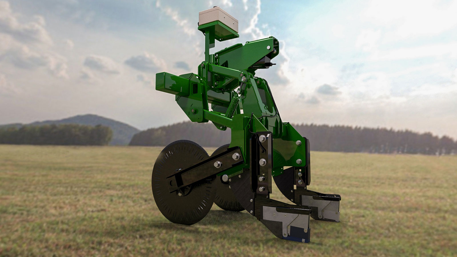
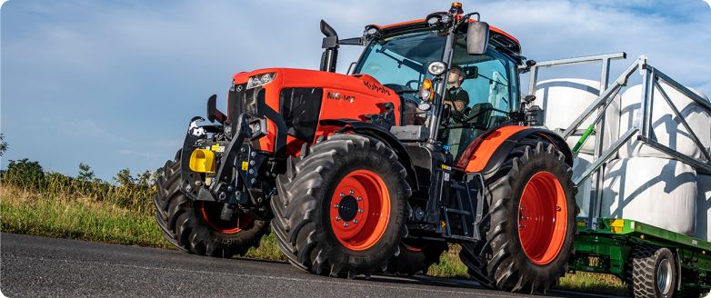
The entire TrueView module quickly bolts into place on the Great Plains Turbo-Max®.
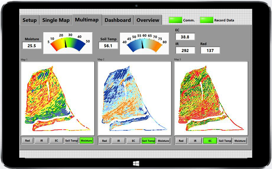
Soil maps created by TrueView show important soil properties that should not be overlooked.
Soil properties to look out for
Soil moisture
By sensing moisture content in real-time, the operator can make consistent tillage adjustments on-the-go. Adopting tillage depth, gang angle or basket down pressure helps to create the most agronomically sound seedbed. TrueView measures soil moisture with a capacitance sensor.
Soil temperature
Depending on the amount of residue on the surface, soil texture and moisture content, soil temperature can fluctuate. Measuring and mapping these fluctuations provides one more data point in making the most informed planting decisions. Our system measures soil temperature at the depth of tillage.
Soil electrical conductivity
Fine-textured soils conduct better than coarser soils. TrueView’s electrical conductivity arrays penetrate throughout the rooting zone, giving producers a profile view of the soil properties across the field.
Soil organic matter
Combined with soil-texture, the organic matter contained within soils provides important information about soil differences like water-holding and nutrient-holding capacity and compaction potential. Our system maps soil organic matter using infrared optics.
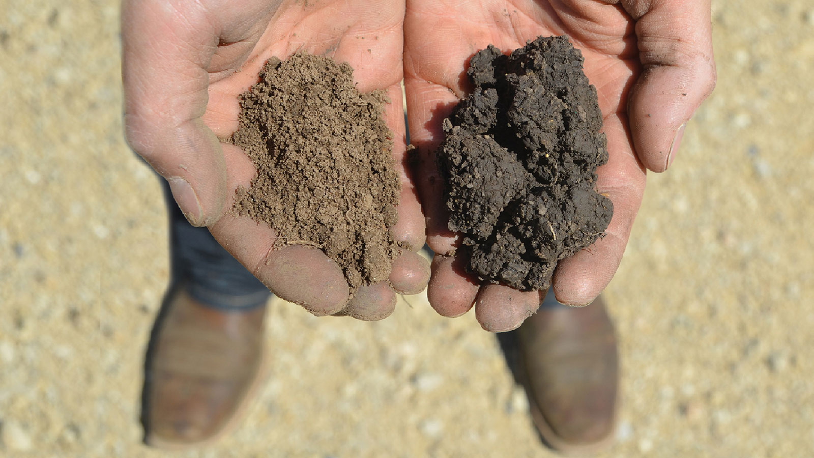
TrueView detects the differences in soil types.
2783 GPI Agritechnica Earth Center TrueView
2783 GPI Agritechnica Earth Center Why We Map
Benefits
What are the benefits of TrueView by Great Plains?
Take soil measurements while completing your tillage pass.
Make immediate tillage adjustments with real-time soil sensing.
Allow for data-driven decisions on future seeding and inputs by relying on highly accurate soil maps.
People
Voices from the Kubota Community
“TrueView captures the most important soil properties. With this information, we can confidently choose different seed populations for each soil, knowing they will get to the right spot. Based on soil variation, we can also adjust nitrogen rates, lime and fertilizer rates, set yield goals, and optimize irrigation management. We have witnessed the benefits of this technology on farms all across the world. Wherever you are, whatever the crop, you can benefit from the micromanagement of soil.”
UN Sustainable
Development Goals
The Great Plains Implement Command System contributes to the UN Sustainable Development Goals of achieving zero hunger, promoting industry, ensuring sustainable development and protecting life on land.


Get in Touch with Kubota